The Pacific Crest Trail and California’s Fire Future
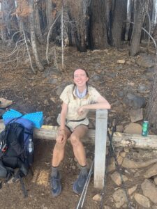
Hello again everyone! Kaitlin here and I’m back with another update from my Pacific Crest Trail thru-hike. I recently passed the halfway point on my journey, at 1,325 miles in. This means I’m in Northern California with about 300 more miles to go (wow, it’s a long state!) before I start heading through Oregon on my journey toward Canada!
 In the two and a half months I’ve spent walking through California so far, one feature that has popped up repeatedly along the way is burn scars. This probably isn’t surprising to any Californians, since large and devastating wildfires in the mountains make the news every year. Having walked through many burned areas along my journey—at many different levels of severity, and various lengths of time passed—I thought it would be interesting to share with you all what I’ve noticed along the way and reflect on the impacts of fire on a long-distance trail like the PCT.
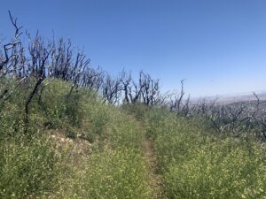
One of my favorite things to do when walking through a burn scar is to search for all the signs of life coming back after the fire. Because I’m a nerd, I also like to look up how long ago the fire was to get a sense of what that recovery looks like over time.
Here are some examples:
One of the earlier burn scars I encountered was from the 2015 Lake Fire in the San Bernardino National Forest, south of Big Bear. This fire burned over 30,000 acres and it was interesting to see the towering skeletons of the huge shrubs that had burned. They had regrown quite a lot from the roots, a process called crown sprouting.
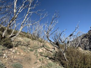
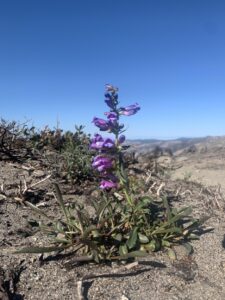
Further up the trail in the Angeles National Forest, I walked through a few burns from 2020- the Bobcat fire and the Lake Fire (no relation to the 2015 fire). There was evidence of crown sprouting shrubs, and lots of open space still in the more freshly burned areas. I was disappointed to see some of the areas with burned shrub skeletons packed full of invasive mustard plants, whichuse the disturbance of a fire to establish and spread. Despite their invasion, lots of areas were full of native wildflowers as well!
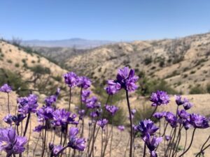
Recently I hiked through a particularly large and devastating burn area that occurred only last season, the Dixie Fire. It burned almost a million acres in the summer and fall of 2021, including about 100 miles of the PCT. It’s the largest single wildfire in California history and it’s been humbling to spend days walking through the burned area seeing the scale of impact first hand. Because it’s so recent, the signs of regrowth are more subtle than other burn areas I’ve walked through—though each little blooming wildflower and hint of green at the base of a shrub skeleton brings me joy.
Having walked through over 100 miles of relatively recent burn areas (within the last few years), what impact does this have on hikers? After a recent heat wave on trail, one of the impacts I really felt was how exposed to the elements you are when you’re in an area with burned out vegetation. You have to be conscious of hazards like falling or fallen trees across trails, washed out sections of the trail after storms, and lack of trail signage, as many signs have burned away. So far I have not had to deal with actively burning fires, which pose a whole different set of challenges to PCT hikers. We shall see what’s in store for me as fire season ramps up!
While seeing the large scale and severity of some of the burn areas can be saddening, and the recent burns pose challenges to a hiker like myself, I’ve still enjoyed those sections in their own way, as I can appreciate the role fire plays in the cycle of regrowth. It’s an inevitable part of hiking in the west these days, and all part of the journey!
Thanks for joining me on this journey! I’ll be back with another update real soon.
-Kaitlin