The Emerald Fire, Coastal Sage Scrub, and You
The Emerald Fire of 2022 burned 155 acres of hillside adjacent to and in Crystal Cove State Park, Orange County, up-slope of the Emerald Bay and Irvine Cove communities. This fire, ignited by overhead power lines, burned in an area called the wildland urban interface (WUI), a space where natural habitat meets urban areas such as housing, businesses, or park facilities.
Fire has been part of California’s landscape for thousands of years, and many of our ecosystems have evolved with fire. For example, California’s coastal sage scrub environments are well-adapted to periodic fires (every 10-20 years) which help stimulate the soil’s seed bank and cause shrubs to resprout from the burned remains. However, the new “normal” in California’s WUIs and beyond includes more frequent and more intense wildfires than previous decades. Since 1920, fires in California have become more frequent and larger due to changing climate conditions and urbanization, putting these habitats at risk when they cannot adapt and recover from fires year after year. Coastal sage scrub specifically has faced devastating habitat loss throughout the state, and frequent fires could contribute to further loss of this endangered habitat if it is not conserved or restored.
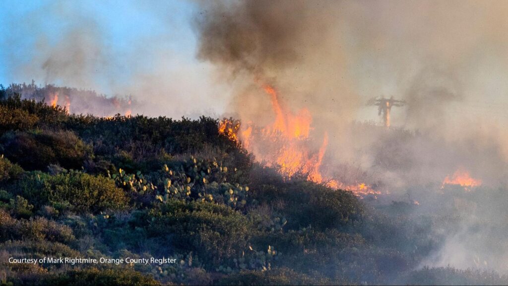
Fortunately, the 2022 Emerald Fire was preceded most recently only by the Laguna Beach Fire in 1993. Thanks to State Parks’ management, volunteers, and others who aid in keeping Crystal Cove’s habitats in good shape, we expect to see great recovery of coastal sage scrub after this fire event, but we need your help! By participating in this community science photo monitoring project, we hope to use this burn site as an opportunity to monitor the recovery of coastal sage scrub post-wildfire, which is where you come in!
The Project
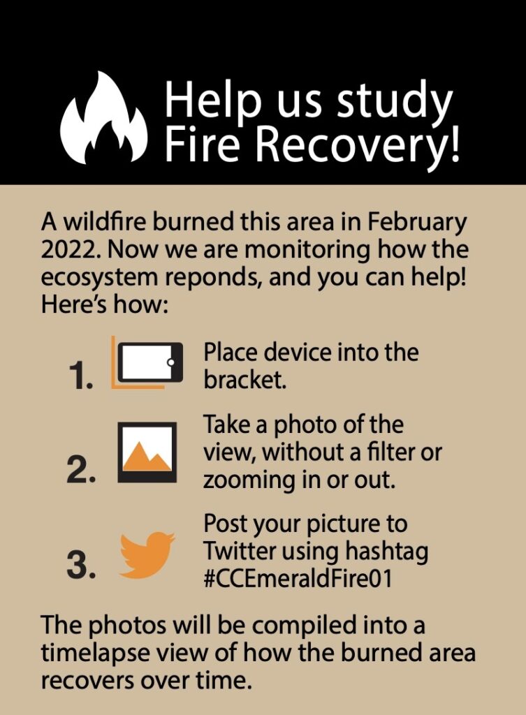
The sign you will see at photo monitoring site #1
In conjunction with California State Parks, Natural Resource Interns from Crystal Cove Conservancy developed a project to install photo monitoring sites at two locations along the Moro Ridge Trail in the Summer/Fall of 2022. The goal of this project is to observe long-term, landscape-level habitat recovery post-fire. By taking photos and posting to social media using the specified hashtags, visitors are contributing to a three-year long qualitative study of vegetation regrowth and change after the 2022 Emerald Fire. Using this photo data, Parks managers can examine patterns of change in regrowth after fire over time, highlighting areas that may need more help recovering such as areas overcome with invasive plants or places that have low vegetation density.
Want to help out? Click here to find out how!


